
Import a GPX course
Bring in a route and ask the coach about it by name.
Updated 4 November 2026
Courses are routes you bring into Form as GPX files: a race course, a favourite loop, a climb you want to understand. Form keeps the file, works out the distance and climbing, finds and categorises the climbs, draws the elevation profile and the route, and lets the coach read all of it when you mention the course by name.
Where to find it
Where to find it
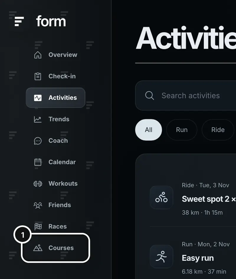
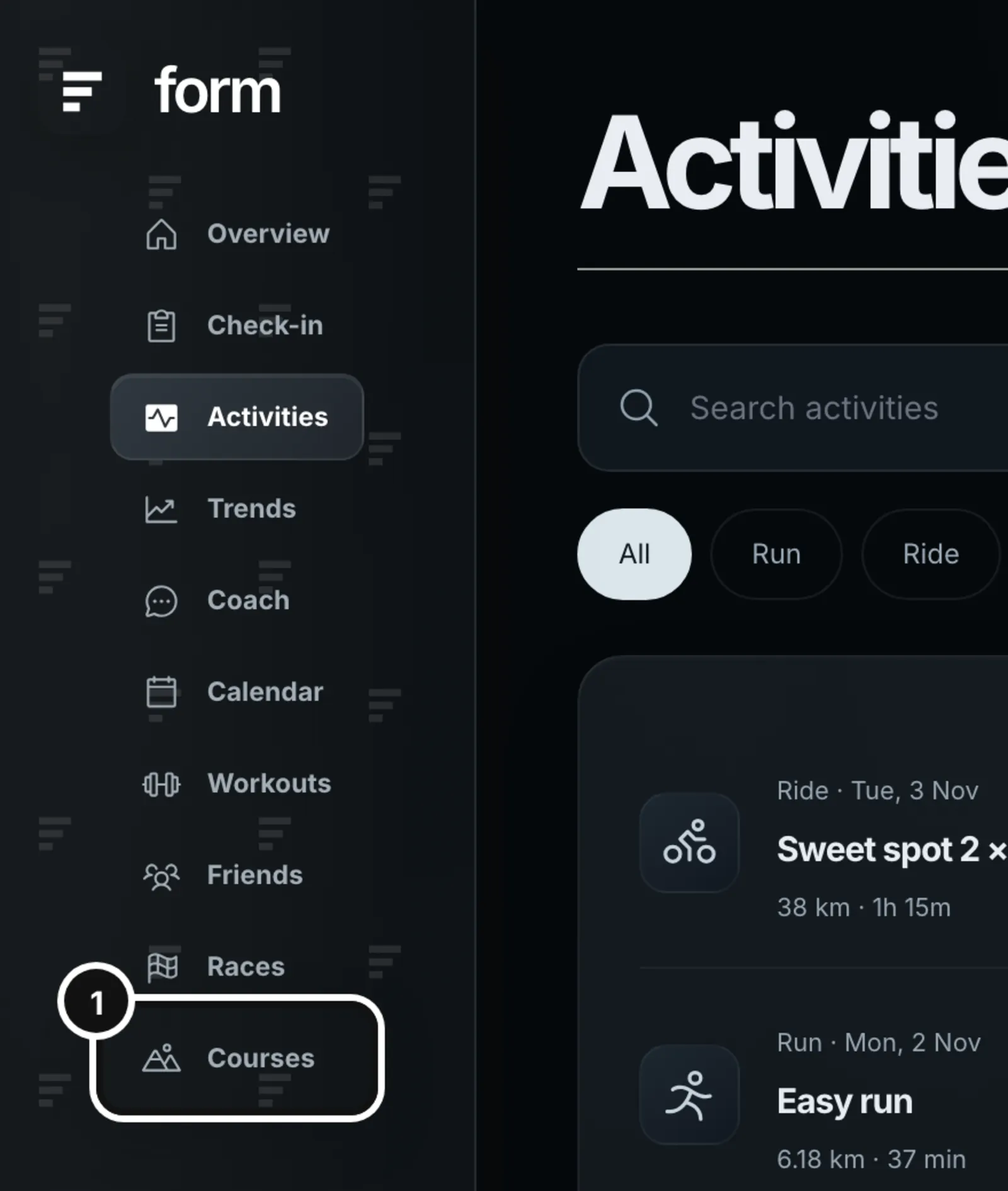
1Click Courses in the left sidebar.
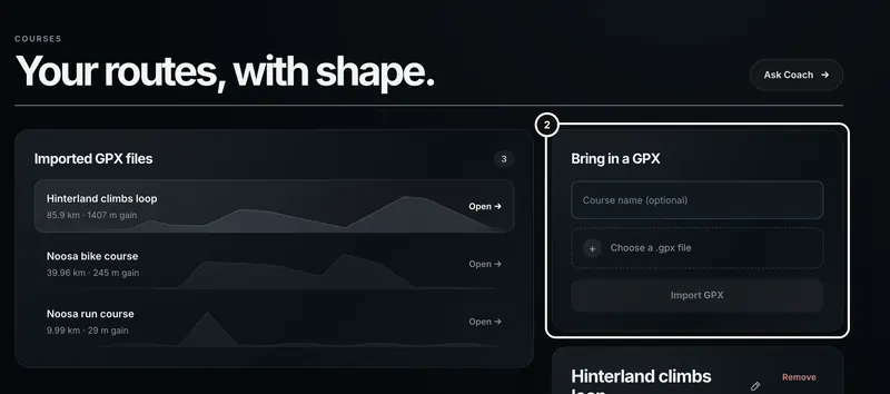
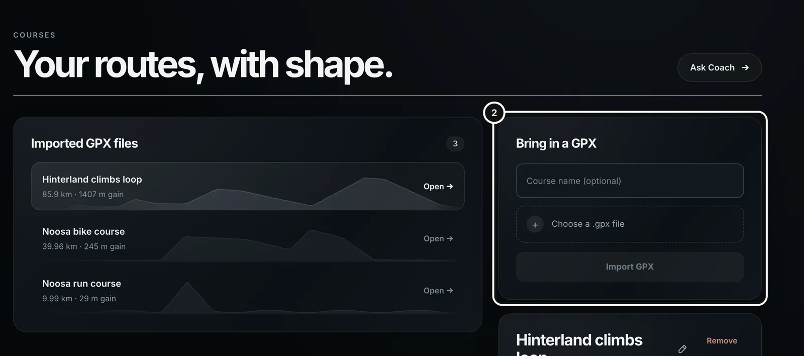
2“Bring in a GPX”, on the right, is where you add a course. Imported courses are listed on the left.
Import a course
- Get a .gpx file from where you plan routes, a race website, or your watch’s or bike computer’s export.
- On the Courses page, type a name in Course name (optional) under “Bring in a GPX”. If you leave it blank, Form uses the file’s name.
- Press Choose a .gpx file and pick the file. Its name replaces the words in the box.
- Press Import GPX. The button says “Importing…” and the course appears at the top of Imported GPX files, already open.
Importing the same file again with the same name doesn’t make a second copy: Form returns the one you already have.
What Form needs in the file
- The file must end in .gpx and be 25 MB or smaller.
- It needs at least two points with elevation. Form reads track points and route points. A file with positions but no elevation is refused with “This GPX file needs at least two points with elevation data.” Export it again from a tool that includes elevation.
- A file that isn’t valid GPX is refused with “This GPX file could not be read. Check that it is a valid GPX export.”
What Form stores
Form keeps the original file, so Download GPX gives it back unchanged, and works out the distance, total climbing and descent, lowest and highest points and number of points. For display it keeps an elevation profile of up to 500 points, which is enough for the chart whatever the file’s length. Your courses belong to your account.
Look at a course
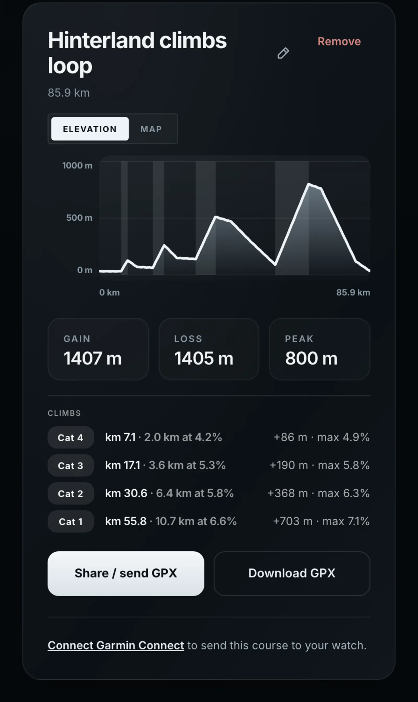
Click a course in the list, or its Open →. The panel on the right shows its name, distance, an elevation chart, Gain, Loss and Peak, and the climbs. The list shows each course’s distance and climbing with a small profile. If the file has no usable profile the panel says “No elevation profile was found in this GPX file.”
Climbs
Form finds the climbs in a course and categorises them the way the Tour does, from Cat 4, the smallest, through Cat 3, Cat 2 and Cat 1 to HC, by how long and how steep each one is. A climb has to be at least 500 m long and average 3% or more. Each one is shaded on the elevation chart, and the Climbs list gives where it starts, its length and average gradient, the height it gains and its steepest part. A flat course has no Climbs list.
When the course is attached to a race, the race estimate times each climb at its own gradient. See Plan a race and estimate your finish.
See the route on a map
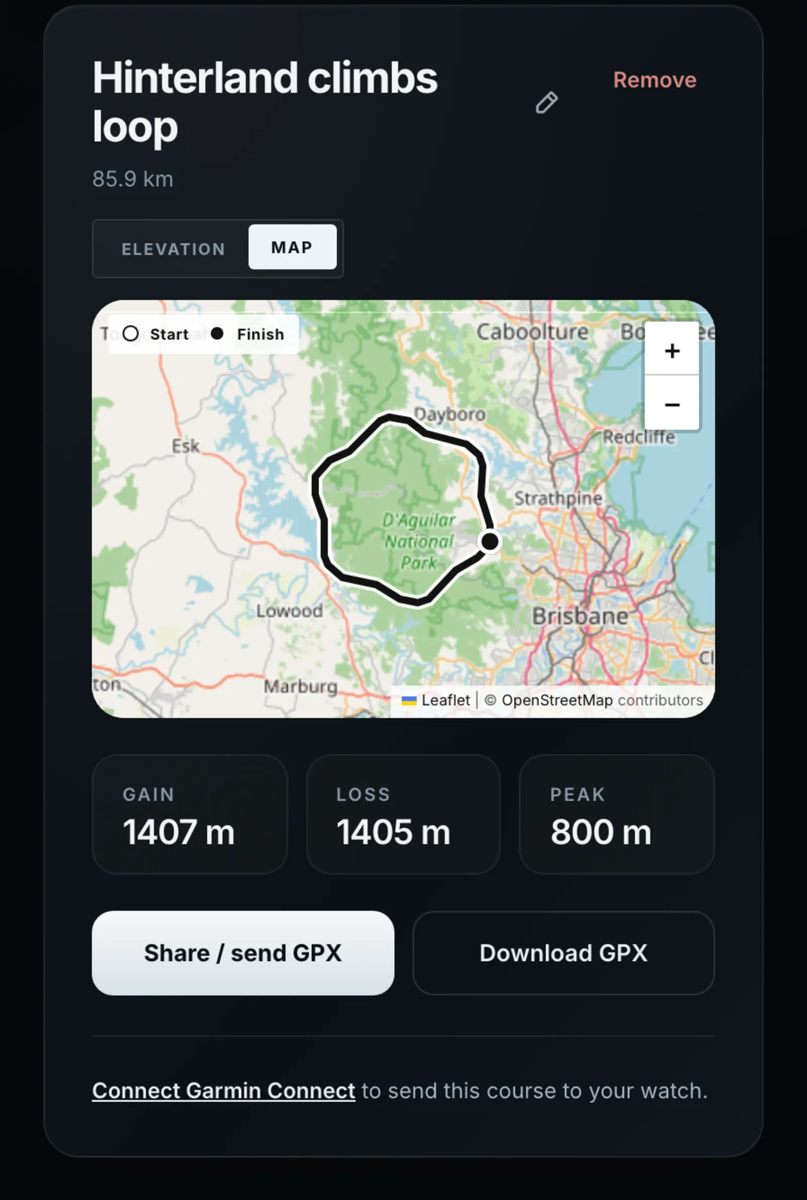
Press Map to see the route on a map, and Elevation to go back. Map only appears when the file has positions. The Climbs list shows with the elevation chart.
Rename, share, download and remove
- The pencil beside the name renames it. Press Save, or Cancel to leave it.
- Share / send GPX opens your device’s share sheet where there is one, for example to send the route to a bike computer app. Where the browser has no share sheet it downloads the file instead.
- Download GPX saves the file.
- Send it to your watch: with Garmin connected, a panel under the buttons sends the course to Garmin Connect and asks which activity type it should be (Road cycling, Gravel cycling, Mountain biking, Running, Trail running, Hiking or Other). If some points in the file are more than 100 m apart, Form warns that the watch will draw straight lines between them. Without Garmin, the panel says “Connect Garmin Connect to send this course to your watch.”
- Remove deletes the course and its stored file, after you confirm in your browser.
Ask the coach about a course
A course is not attached to a message the way a session is. Its name goes into your message, and Form finds it there. Ask Coach at the top of the Courses page opens a new coach chat.
- Open the coach and start typing a message. Type @ to see suggestions: your saved courses appear alongside sessions and races. Choosing one writes the course’s name into your message. In the Form app the row reads Insert, not Attach.
- Or just type the name yourself, such as “How should I pace the climbs on Hinterland climbs loop?” Form matches the name anywhere in your message, whatever the capitals.
- Send it. The coach reads the route’s distance and climbing as it answers, and the reply shows a course card so you can see which route it used.
If you have exactly one course and your message mentions a course, route, GPX, elevation, climb or hill without naming it, Form assumes you mean that one. Because the match is on the name, give courses distinctive names: a course called “Loop” will match any message that contains the word.
You can also ask the coach to find a race course and save it. When it finds a direct GPX link it imports it into Courses for you, and it appears in the list like any other.
Other places a course is used
- Races: on the Races page, Attach connects one of your courses to a saved race, so the race and its route stay together.
- The race page: a triathlon takes a bike course and a run course on its Courses tab, and the estimate uses the climbing of each. See Plan a race and estimate your finish.
- The trainer: in the course picker, the “Saved courses” tab lists your courses. To ride one, the file has to be 5 MB or smaller, the route between 100 m and 30 km, and no more than 8,192 points. The trainer says so if it can’t build it. Save a shorter section as a new course if yours is too long.
If something goes wrong
- A message above the list says why an import failed. The file isn’t stored, and you can try another.
- If Form can’t find a course’s stored file, Share / send GPX says “Could not prepare this GPX file for sharing.”
- “Could not remove this course.” means the delete didn’t go through. The course is still there; try again.
Common questions
- Why was my GPX refused for having no elevation?
- Form builds the profile, the climbing figure and the climbs from elevation, so each point needs it. Many planners add elevation on export; check the export options, or load the route into a tool that adds it.
- How does Form decide a climb’s category?
- By its length and average gradient together, the way the Tour does: a long, steep climb is Cat 1 or HC, a short, gentle one Cat 4. Anything under 500 m long or 3% average isn’t counted as a climb.
- Can I import a route by URL myself?
- Not from the Courses page, which takes a file. The coach can import a public GPX link when you ask it to find and save a route.
- Does importing a course use up my coach allowance?
- No. Importing is not a coach request. Asking the coach about it is, like any other question.
- Is my course private?
- Yes. Courses belong to your account and aren’t visible to friends or anyone else.